
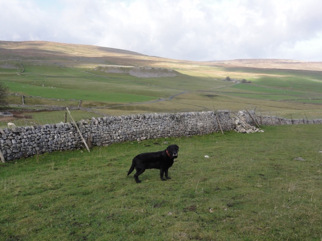
I had the opportunity last week to head up North for another Spine Challenger recce and some running and wild camping on the Pennine Way. I managed to coincide this with the first real cold snap of the winter, so was glad to have my Labrador, Bamber along with me to provide a large (if somewhat bog-covered) hot water bottle!
Day 1: Hebden Bridge to Walshaw Dean Reservoir (7.5 miles)
Other commitments meant that I didn’t reach Hebden Bridge until about 3.30pm. I found a place to leave my car near the station ready for the return journey and set off through the town to pick up the Pennine Way. As I climbed the steep bank out of Hebden Bridge, the sun was already starting to set and the sky was a stunning shade of pink. The route above Hebden Bridge follows a series of narrow paths, now becoming increasingly muddy as winter approaches, and steep steps to negotiate the various valleys. It was therefore a relief to reach the start of Heptonstall Moor, where I actually found the terrain easier (despite the bogs!).
By now it had got dark and I decided to carry on for a while and practise my night navigation across the moors. It was a beautiful starry night and I loved looking down from the blackness of the moor to the occasional lights of a house in the valley below. I think the isolation of the moorland sections is my favourite aspect of the Pennine Way!
Walshaw Dean Reservoirs were quiet other than a few sheep and when I reached the far end I found a nice sheltered spot and decided that it was time to set up camp for the night. I was very impressed with my new Alpkit stove, which had boiled the water for my dehydrated meal before I had even finished getting the tent up!
Day 2: Walshaw Dean to North of Gargrave (22 miles)
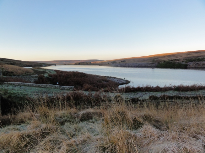
The morning dawned clear and bright and my tent was sagging slightly under the weight of the overnight frost. Having packed up and filtered some water from a nearby stream to fill my bottles, it was time to begin the climb up to Top Withens. I soon warmed up in the morning sun, but had to take care on the icy flagstones.
As a Bronte fan I have wanted to visit Top Withens for some time; the location was suitably stunning and certainly reminiscent of Wuthering Heights (even if a direct literary link seems slightly tenuous!). From here it was a lovely run down to Ponden and a descent into some pretty Dales pastures, followed by a steep climb up from Ponden reservoir before a long steady drag up onto Ickornshaw Moor.
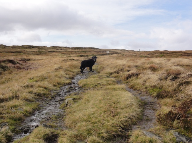
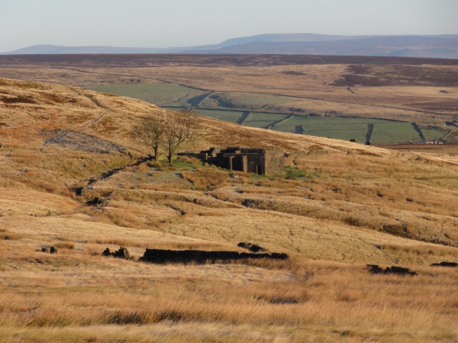
Ickornshaw Moor was very beautiful, but boggy and isolated. Descending from the moor I was intrigued by the many shooting huts that line the path; later investigation suggests that these belong to the villagers who still own the shooting rights on the moor. I was put off gathering water from a stream here having seen a dead sheep near the water higher up, so was relieved to come across a gardener on the outskirts of Cowling who kindly filled up my bottles in his house!
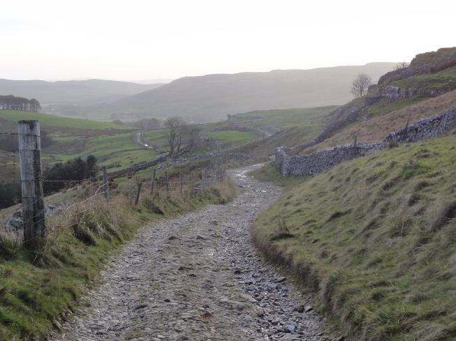
From here the Pennine Way winds its way through a seemingly endless series of farmers’ fields, most of which were very wet and churned up by cattle. I was glad that my waterproof socks prevented my feet from being immersed in the stinking mud!
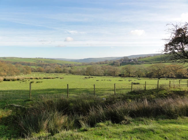
Coming down to Thornton-in-Craven across a particularly revolting field, I didn’t know whether to be amused or irritated by the farmer, who had stretched an electric fence right across the field, including the footpath. Trying to wriggle myself and a large pack underneath the fence, without getting zapped or covered in mud was certainly interesting!
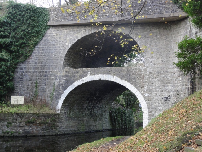
There was a brief respite from the muddy fields as the Way joined the Leeds to Liverpool canal with some very interesting bridges, but soon I was back to trudging across muddy fields again.
Coming down towards Gargrave I encountered a field of young cattle who displayed rather too much interest in us, but scattered when I gave them my best Yorkshire farmer impression at full volume! Once in Gargrave I detoured to the Co-op to pick up some supplies, before heading on across yet more fields of livestock. It was getting dark again and I wasn’t too keen on meeting many more cattle in the gloom, so decided to find a suitable place to camp for the night.
Day 3: Gargrave to Horton (20 miles)
After a rather interesting time trying to pack up my tent in gale force winds, I set off and was pleased to find that my legs felt none the worse for the previous day’s efforts. It was also a relief to discover that the cows on this section seemed well used to people and their dogs and we didn’t have any more problems. The next section was pretty, if unremarkable, following the River Aire along the valley to reach the rather grand hamlet of Hanlith. From here there was a sharp climb up through Hanlith, before heading across the fields towards Malham.
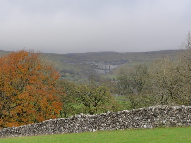
Soon a first view of beautiful Malham Cove came into sight and the dramatic views continued as I descended towards Malham itself. It was only about 9.30am and few places were open yet, but the public toilets provided an opportunity to top up with water and get rid of my rubbish.
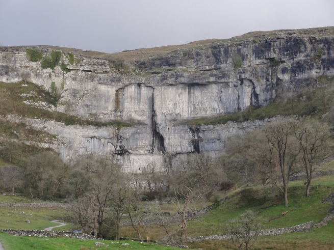
The next section follows a well trodden path to one of the highlights of the Pennine Way at Malham Cove, before climbing the steep steps up the side of the cove and crossing the limestone pavement. I found a reasonable route through here avoiding most of the slippery limestone, although I need to have a look at some satellite images as I think I could have missed out even more of the limestone paving. Then I followed a beautiful section of the path as it winds its way through the limestone crags and on towards Malham Tarn.
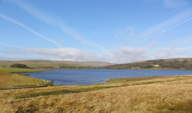
Malham Tarn was shining a beautiful blue in the sunshine. I passed the Field Centre and kept an eye out for the bird hut which is a possible bivvy location during the race itself. Then it was time to negotiate some more fields of cattle before beginning the climb up to Fountains Fell.
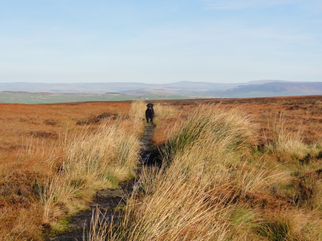
Fountains Fell was stunning and remote with vast views, although the climb does go on for quite a while! As I reached the summit I was treated to a fabulous view of Pen-y-Ghent, with Ingleborough just behind. I didn’t stop for long though as I was now exposed to the westerly wind and my eyes were watering as I made my way down the tricky descent as quickly as I could.
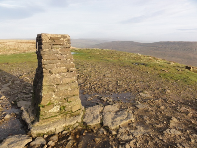
I made my way along the road to Dale Head and the start of the climb up Pen-y-Ghent. I stopped in a sheltered spot to put on extra layers as the wind was now blowing strongly and the “hill of the winds” is windy at the best of times! I have fond memories of the path up Pen-y-Ghent from Dale Head, having taken my children up this way during the summer and so I was smiling as I made my way to the top. For once I even managed to have the summit to myself and enjoyed the views back towards Fountains Fell and on down towards Horton. Then it was time for a last descent down the long path to Horton.
Thoughts for the Spine Challenger
1. It really is slow going!
I have now recced all of the course and would be fooling myself if I thought that there was going to be much running involved in this race! The constantly relentless terrain, combined with a heavy pack means that there are few sections where it is easy to run and any running resembles more of a shuffle. And this is before any snow has been thrown into the mix! It has become abundantly clear why there is a time limit of 60 hours for the Spine Challenger.
2. Shoe/sock success
I have finally found a shoe and sock combination which seems to work for me. I wore La Sportiva Akashas, with knee length Dexshell waterproof socks and my normal Hilly monoskin socks underneath. I also wore Sprayway walking gaiters, which kept any debris out of my shoes.
My feet stayed completely warm and dry the whole time and, other than a couple of small slips on ice, I had great grip on pretty much every surface.
3. GPS
I am still finding it frustrating to use my handheld GPS. I think my preferred solution will be to have it set up to follow the course in my front pouch so that I can use it to check my navigation when needed, but to primarily use my normal system of paper map with a grid reference check from my watch if required.
Other than a few small purchases I now have all my race kit and have recced the whole course. Now there’s just time for a few more weeks of high mileage and I will be all ready to go!

Another great Blog Lizzie. Good Luck on race day.
LikeLike
Thanks Peter.
LikeLike
That’s a helluva challenge! Good luck with the weather 😉
LikeLike
Thank you!
LikeLiked by 1 person
The reservoir looked a great spot for a camp. Great adventure.
LikeLiked by 1 person
Wow, I’m a backpacker and a runner but not sure I could combine them! Good luck with the challenge. Popped over from Outdoor Bloggers.
LikeLiked by 1 person
Well, this looks like an amazing walk . . . good luck with the run?!! 😀
LikeLiked by 1 person
Thanks for your blog, Lizzie. I’m doing a Spine recce next Friday/Saturday – Hebden Bridge to (maybe) Hawes. I’ll be bivvying! It’s decades since I did this stretch, so interested in your comments about the state of the fields – I can’t imagine it’s changed that much. I’m beginning to think my 3mph schedule is looking dodgy! Thanks again.
LikeLike
Enjoy your recce Garfield. I was amazed at how slow going the Pennine Way can be! At least you will be prepared for this come the race!
LikeLike